

Bedzinski County and District Olkuski during the Polish Kingdom or historical Basin Dabrowski
County Calendar Będzin
1867 - The Polish Kingdom has a as a result of administrative reform which created 10 provinces and 84 counties - including Bedzinski District, which was separated from the part of the district Olkusz. The newly created district was part of the Government Piotrowska, and its area was 1,366.5 km2.
1889 - Joining the county Będzin Zawiercie Little, after adjusting for county area increased to 1,390 km2, and its population was about 80,000.
1916 - Authorizing the city rights and the creation of Dąbrowa County Dabrowski (except Dąbrowy entered its component municipalities: Horon, Gołonóg, Kromołów, Łosień, Niegowa, Strzemieszyce).
1919 - Establishment of county-Dabrowski będzińsko or de facto merger of two adjacent counties. District entered into rocks of the Kielce province (2 August 1919. And so soon after Poland regained independence, was created in the former Polish Kingdom five provinces, including Kielce, consisting of 16 counties).
1923 - Return to the original name or district będzińsko-dąbrowski changes its name to "Będzin. Its surface was then about 1,426 km2, and the population reached to nearly 400,000.
1927 - Establishment of county Zawiercie, which has expanded to most of the within the county Będzin (see the map).
1934 - Establishment of county grodzki in Sosnowiec.

Bedzinski County and the surrounding lands in 1935.
1945 - District Bedzinski is incorporated into the newly created province of Silesian-Dąbrowski.
1948 - Establishment of county grodzki in Bedzin, the city remains the capital of the county or the earth.
1949 - Establishment of county grodzki in Dabrowa.
1951 - Czeladź grodzki obtains the status of the county.
1953 - Niwka is incorporated in Sosnowiec and Trzebyczka becomes part of the county Zawiercie.
1973 - Inclusion of the county Ożarowice tarnogórskiego.
1975 - Introduction of administrative reform in Poland, which was created as a result of 49 provinces, while eliminating all the districts. Outgrowth of the county became the District Offices, the scope of activities normally coincide with the boundaries of old districts.
1999 - another administrative reform - created 17 provinces, and Będzin back became the capital of the district (in also entered into its composition: Czeladź, Wojkowice, Siewierz, Psary, Mierzęcice and Bobrowniki). The newly created province was given the name "Silesia".
2002 - The district enrolled Będzin Slavkov.
2007 - 140 years of Będzin DISTRICT.
Below Dąbrowa Basin maps showing how changing the boundaries of countries, regions, counties and municipalities throughout history, and how they look in today's world.
Historical:
Municipalities, counties, provinces - in 1937

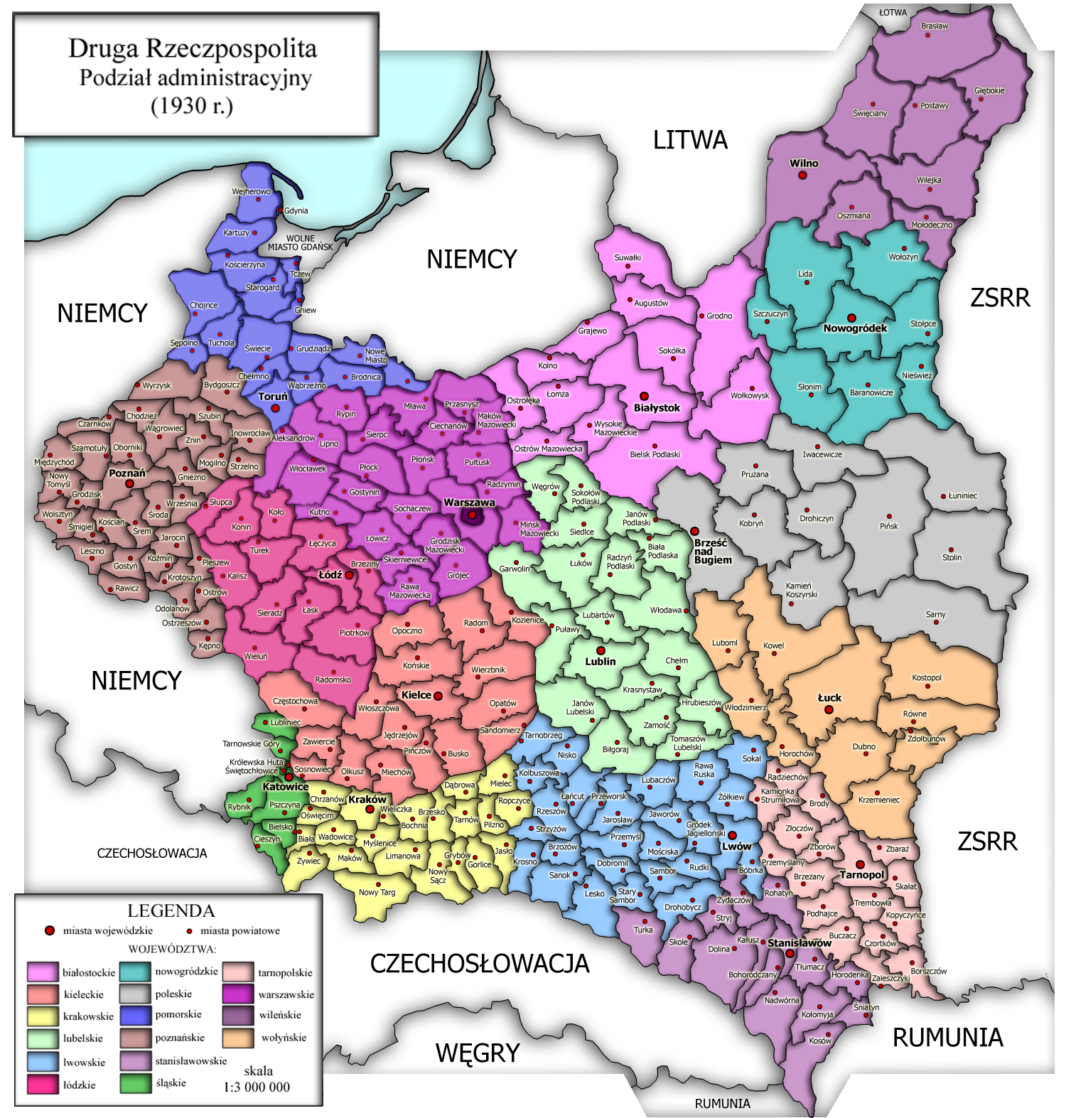
II RP - the year 1930
breakdown by provinces - 1923

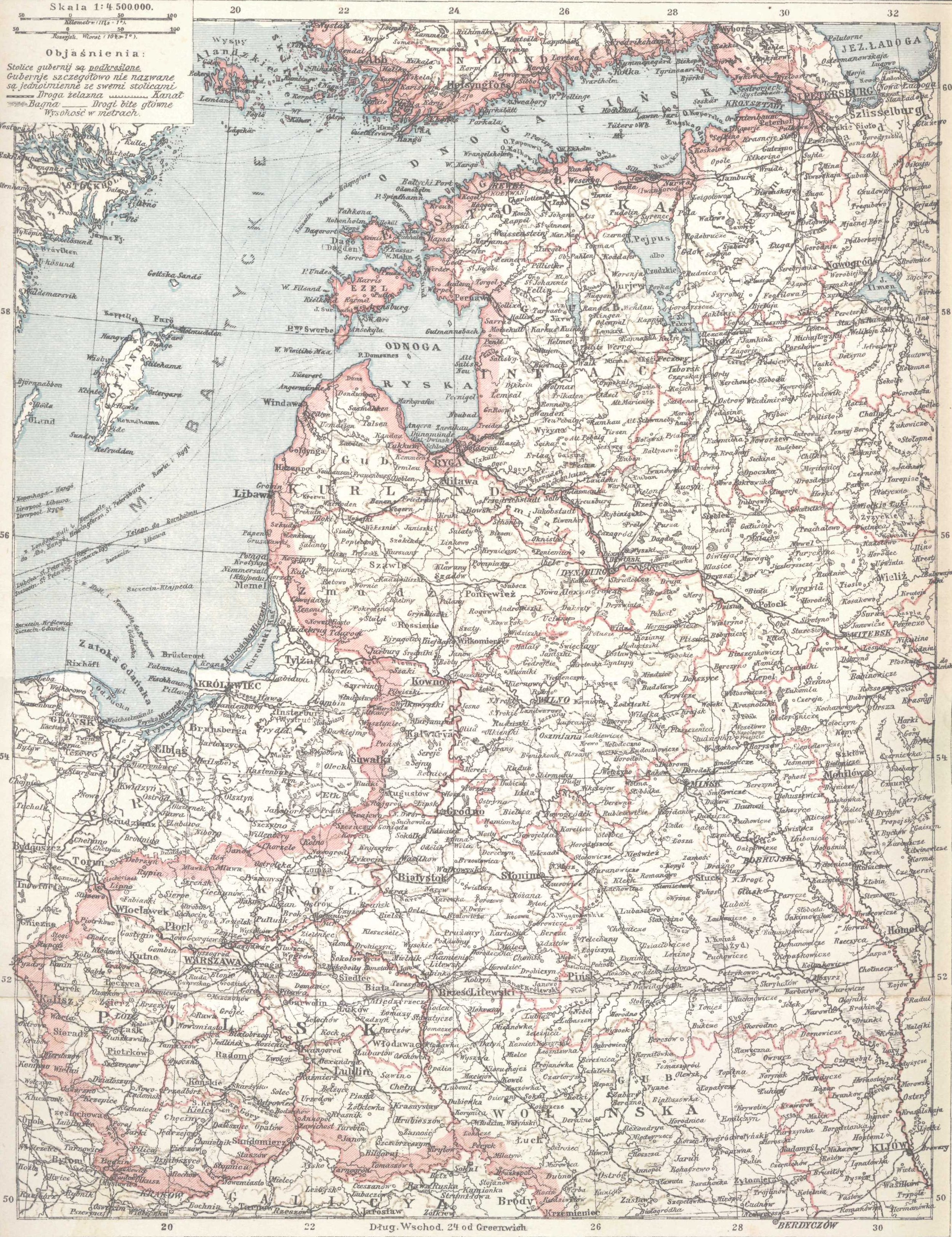
Triangle of Three Emperors - 1917

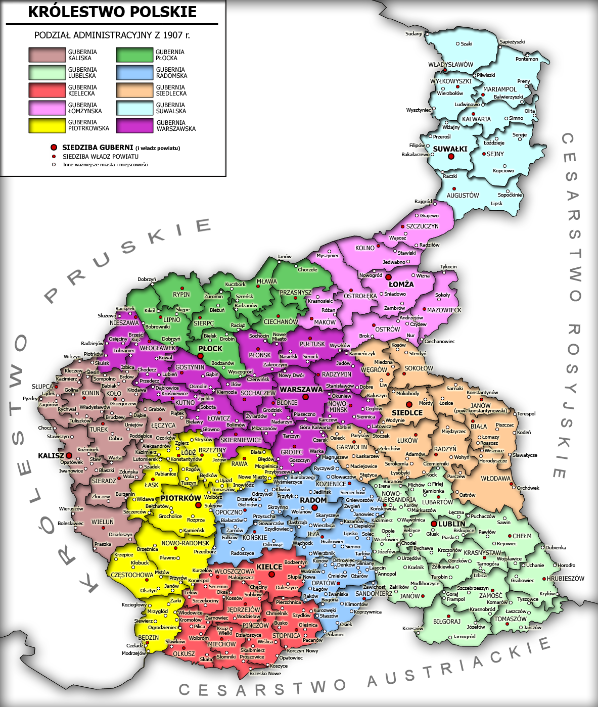
Polish Kingdom - Year 1907
Polish Kingdom - 1902
boundary line and the Malopolska Silesia - the year 1736

and RP - the year 1635, woj. Krakow [which included Będzin]

and RP - the year 1619, the provinces of the Republic [selected Duchy Siewierski which included Czeladź]


County Lelowski - year 1500

Poland for Boleslaw [Bytom subject to the Malopolska]

Internet:
Czeladź

Sosnowiec
District Olkuski
Today:
Dabrowa Mining Plan
Municipality Keys

Częstochowa County

_____________
more historical maps in high resolution on mapyregion.wordpress.com
0 comments:
Post a Comment